
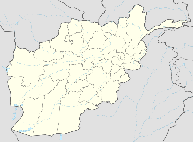
ચિત્ર:Afghanistan adm location map.svg

મૂળભુત ફાઇલ (SVG ફાઇલ, માત્ર ૧,૮૦૭ × ૧,૩૩૧ પીક્સલ, ફાઇલનું કદ: ૩૦૫ KB)
સારાંશ:
| વર્ણન |
Deutsch: Positionskarte von Afghanistan
English: Location map of Afghanistan
پښتو: د افغانستان نقشه
|
||||||||||||
| તારીખ | |||||||||||||
| સ્રોત |
Own work using:
|
||||||||||||
| લેખક | NordNordWest | ||||||||||||

|
This map has been made or improved in the German Kartenwerkstatt (Map Lab). You can propose maps to improve as well.
|
પરવાના
Usage of this file with:

explanatory notes: Legally binding is only the full legalcode. For a free usage I recommend to respect the following licence conditions:
1. Provide my name as given above: NordNordWest,
2. a copy of, or the URI for, the applicable license: https://creativecommons.org/licenses/by-sa/3.0/de/legalcode,
3. the title of the work,
4. in the case of an adaptation, a credit identifying the use of the work in the adaptation.
This license and the rights granted hereunder will terminate automatically upon any breach by you of the terms of this license. Any of the above conditions can be waived if you get permission from the copyright holder. If you have questions or wish differing conditions, please contact me through nnwest or my discussion page ![]() t-online.de
t-online.de
- તમે મુક્ત છો:
- વહેંચવા – નકલ કરવા, વિતરણ કરવા અને રચનાઓ મોકલવા
- રીમિક્સ કરવા કે મઠારવા – રચના અપનાવવા
- નીચેની શરત હેઠળ:
- આરોપણ – તમારે આ રચનાનો ઉપયોગ કરવા માટે લેખક કે પ્રકાશન અધિકાર ધારકની યોગ્ય માહિતી, પરવાનગી (લાયસન્સ)ની કડી અને તેમાં ફેરફાર કર્યો હોય તો તેનો ઉલ્લેખ કરવો જ પડશે. તમે આ સત્તા અનુસાર જ આ રચનાનો પ્રયોગ થવો જોઈએ, પણ તેઓ તમને અથવા તમારા ઉપયોગ સાથે સંમત થાય છે તે રીતે નહીં.
- શેર- અલાઈક (બિન ભેદભાવ વહેંચણી) – તમે જો આ રચનાને બદલશો, તેમાં ફેરફાર કરશો અથવા તેના પર આધારિત કોઇ કાર્ય બનાવશો તો તમારે પરિણામી કાર્યને તે જ અથવા અનુરૂપ પરવાનગી હેઠળ જ પ્રકાશિત કરવું પડશે.

ફાઇલનો ઇતિહાસ
તારીખ/સમય ઉપર ક્લિક કરવાથી તે સમયે ફાઇલ કેવી હતી તે જોવા મળશે.
| તારીખ/સમય | લઘુચિત્ર | પરિમાણો | સભ્ય | ટિપ્પણી | |
|---|---|---|---|---|---|
| વર્તમાન | ૨૩:૪૧, ૨૫ સપ્ટેમ્બર ૨૦૧૪ | | ૧,૮૦૭ × ૧,૩૩૧ (૩૦૫ KB) | NordNordWest | == {{int:filedesc}} == {{Information |Description= {{de|1=Positionskarte von Afghanistan}} {{en|1=Location map of Afghanistan}} {{Location map series N |stretching=115 |top=38.8 |bottom=29.0 |left=60.0 |right=75.3 }} |Source={{Own using}} * World Data... |
ફાઇલનો વપરાશ
આ ફાઇલ માં નીચેનું પાનું વપરાયેલું છે:
ફાઇલનો વ્યાપક ઉપયોગ
નીચેની બીજી વિકિઓ આ ફાઈલ વાપરે છે:
- af.wikipedia.org પર વપરાશ
- an.wikipedia.org પર વપરાશ
- ar.wikipedia.org પર વપરાશ
- ast.wikipedia.org પર વપરાશ
- Fayzabad
- Ishkashim
- Khandud
- Qal'eh-ye Panjeh
- Qala i Naw
- Bala Murghab
- Puli Khumri
- Baghlan (ciudá)
- Nahrin
- Dahana i Ghuri
- Andarab
- Tash Gozar
- Sholgara
- Qarchi Gak
- Dawlatabad (Balkh)
- Balkh (ciudá)
- Mazar-e Sharif
- Bamiyan (ciudá)
- Panjab
- Nili
- Farah (capital)
- Shindand
- Anar Dara
- Maymana
- Andkhoy
- Darzab
- Dawlat Abad
- Ghazni (capital)
- Chaghcharan
- Taywara
- Lashkar Gah
- Sangin
- Herat (ciudá)
- Obe
- Islam Qala
- Ghurian
- Karukh
- Kohsan
- Kushk
- Toraghundi
- Tir Pol
આ ફાઇલના વધુ વૈશ્વિક વપરાશ જુઓ.